Launched in partnership with Old No. 7 Fishing, The Billfish Foundation’s Caribbean Project is a satellite tagging mission focused on understanding the movement and connectivity of white and blue marlin populations across the Atlantic.
Positioned along a critical migratory corridor, the Caribbean provides a unique opportunity to study how billfish move through what researchers often refer to as the “Atlantic Marlin Highway.” These waters serve as an important crossroads between the Caribbean, the Gulf of Mexico, and the U.S. East Coast.
Building on the community-driven model of TBF’s Groundswell Projects, the Caribbean Project brings together the sportfishing community, scientific researchers, and conservation leaders to generate new insights into billfish migration and behavior.
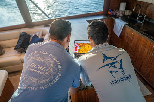
Conducted aboard the Old No. 7, a 70’ Spencer, this project is deeply rooted in generations of sportfishing heritage, alongside researchers from the University of Southern Mississippi’s Center for Fisheries Research and Development.
Together, this collaboration is helping advance science-driven management of Atlantic billfish populations.
The Caribbean sits at the center of one of the Atlantic Ocean’s most important billfish migration corridors.
White and blue marlin move through these waters as they travel between major feeding and spawning grounds across the Atlantic basin.
However, key questions remain:
• How are marlin populations connected between the Caribbean, Gulf of Mexico, and the U.S. East Coast?
• What migration routes do these fish follow across the Atlantic?
• What depths and temperatures do they prefer while traveling through this region?
• How does the Caribbean function as a corridor for Atlantic billfish movement?
Early data collected from tagging efforts already suggests potential connectivity between the Caribbean, the Gulf of Mexico, and the Northeast United States, insights that could play an important role in future cross-border conservation and fisheries management.
By studying billfish in this strategic location, researchers can better understand the broader migratory network that links Atlantic billfish populations.
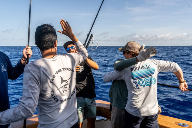
Through partnerships with experienced captains, anglers, and scientific researchers, satellite tags are deployed on healthy billfish during sportfishing expeditions.
These tags allow scientists to track fish movements and collect environmental data over extended periods of time.
The Caribbean Project utilizes Pop-Up Archival Satellite Tags (PSATs), an advanced tracking device designed to collect detailed environmental and behavioral data from billfish in the open ocean.
Once deployed, a PSAT records:
• Depth (vertical movement patterns)
• Ambient water temperature
• Light-based geolocation data
• Time-at-depth and habitat preference
After a pre-programmed period, typically around 6-12 months for this project, the tag automatically detaches from the fish, floats to the surface, and transmits summarized data via satellite to researchers.
Scientists then use this data to reconstruct migration routes, analyze habitat preferences, and better understand billfish behavior across the Atlantic.
Because billfish are highly migratory and travel vast distances across international waters, satellite tagging provides one of the only reliable ways to study their movement patterns at scale.
During one of the project’s initial expeditions in Marsh Harbour, Bahamas, the team successfully deployed:
• One 8-month satellite tag on a blue marlin, which just popped off in late February after being on the fish for the full duration of 8 months. We are eager to see where this fish traveled.
• One traditional tag on a sailfish
This work represents the first phase of a broader research effort.
With six additional satellite tags remaining, The Billfish Foundation, Old No. 7 Fishing, and new boats participating will continue deployments and expand the project through 2026, contributing valuable data to international billfish conservation efforts.
Like many of TBF’s Groundswell Projects, the Caribbean Project highlights the critical role anglers play in advancing billfish science.
By working directly with experienced sportfishing teams and captains, the project:
• Expands scientific data collection in key migratory regions
• Promotes best handling and release practices
• Strengthens angler-driven conservation
• Builds collaboration between the fishing community and researchers
This approach ensures that the people who interact with billfish most often are also helping protect them.
The Caribbean Project contributes to The Billfish Foundation’s 40 for 40 Campaign, celebrating TBF’s 40th anniversary by committing 40 satellite tags in support of billfish conservation and science.
Each tag deployed helps researchers better understand billfish behavior across international waters and supports stronger fisheries management for the future.
Every tag brings us closer to:
• Stronger science
• Smarter management
• Sustainable billfish populations for generations to come
The Caribbean Project demonstrates how collaboration between anglers, scientists, and conservation organizations can generate meaningful research in critical billfish habitats.
Together, we’re proving that community drives conservation.
Interested in becoming a tag sponsor?
Please Note: This is only a donation to The Billfish Foundation.
Your funds will be directed to the program of your choice and not towards a membership.
To become a member, click here.